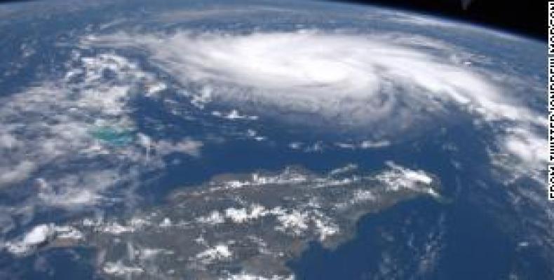
Miami, August 30 (RHC)-- The slow march and rising intensity of Hurricane Dorian, which is moving in a northwestern direction to the Bahamas, has alarmed forecasters who worry parts of Florida will be walloped by strong winds, a storm surge and heavy rain for an extended period.
"I think there’s a pretty high degree of certainty that this is going to be a major hurricane," Florida Governor Ron DeSantis told a news conference from the state emergency operations center in Tallahassee. He said residents should prepare for a "multiday event."
Two thousand National Guard troops have been mobilized for the hurricane, with another 2,000 joining them on Saturday, Florida National Guard Major General James Eifert said. Florida is under a declaration of emergency. In neighboring Georgia, Governor Brian Kemp has declared a state of emergency in 12 counties to assist with storm readiness, response and recovery.
Dorian is also expected to bring a life-threatening storm surge and flash flooding to the northwestern Bahamas, the Miami-based National Hurricane Center (NHC) said in its latest advisory at 11 a.m. (1500 GMT). "Almost everyone has left, or is leaving today,” said Pauline Powell, 26, who was on a family vacation at the Island Seas Resort in Grand Bahama when the storm started barreling toward the area's pristine beaches.
The Bahamas Ministry of Tourism and Aviation said hotels and resorts throughout that part of the island nation have activated hurricane response programs, which typically include boarding up beach-facing windows and encouraging guests to leave.
The Grand Bahama International Airport in Freeport has closed Friday night and will not open until Tuesday, September 3, the ministry said in a statement.
As a Category 4 hurricane, its winds are now blowing at more than 130 mph (210 kph). It is currently moving at a pace of 10 miles per hour (16 km/h), giving it more time to intensify before making landfall.
Forecasters predicted it will be near the Florida peninsula late on Monday. They expect a storm surge of as much as 10 to 15 feet (3 to 4.5 meters) above normal in some coastal waters of the Bahamas and Florida, and rainfall of about 6 to 12 inches (15 to 30 cm), with up to 18 inches (46 cm) in some areas.