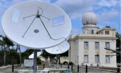
Insmet headquarters. Photo taken from Juventud Rebelde
Havana, Dec 16 (RHC) The Cuban Institute of Meteorology (Insmet) issued Special Warning number two on the meteorological situation in western Cuba, due to an extratropical depression that is intensifying, moving in the Gulf of Mexico and adjacent areas.
The text refers that the extratropical depression is organizing and intensifying rapidly, will continue to move northeast towards the northern portion of the Florida peninsula and will maintain its influence over the western region of Cuba.
In the images of the meteorological satellite and radar of La Bajada, located in Pinar del Rio, the formation of the cold front with a pre-frontal line with clouds, rains and thunderstorms in the southeast of the Gulf of Mexico is observed, which is gradually approaching the western Cuba.
The warning adds that this situation has increased clouds and rains in the western region, with the report in the last 12 hours of 53.0 millimeters in La Fe, 49.0 millimeters in Punta del Este and 41.0 millimeters in the Cuba-France weather station, in the Special Municipality Isla de la Juventud.
The band of pre-frontal clouds will begin to affect the provinces of Pinar del Río and Artemisa in the coming hours with showers, rains and thunderstorms.
These precipitations could become heavy and intense in some localities. The possibility of severe local thunderstorms is not ruled out. Winds will blow from the south, somewhat strong, with speeds between 20 and 35 kilometers per hour, with higher gusts in areas of showers and thunderstorms.
Light coastal flooding will occur in low-lying areas of the southern coast of the western provinces. Water accumulations in coastal areas may increase the extent of flooded areas, due to the combined effect of sea conditions and rainfall.
Special Advisory Two adds that the cold front will gradually move eastward over the Gulf of Mexico, approaching the national territory and will reach western Cuba during the early hours of Sunday.
The combination of extratropical low pressure in the southeastern United States and continental high pressure will generate strong winds from the northwest region between 25 and 40 kilometers per hour, with higher gusts, which will persist until Monday over the Gulf of Mexico and western Cuba.
This situation will cause strong swells on the north western coast, with light to moderate coastal flooding in low-lying areas of this coastline, including the Havana seawall, starting on Sunday 17.
Instec's Forecast Center is keeping a close watch on the evolution of this meteorological situation and a new Special Warning will be issued if necessary (Source: Insmet).

